Lake Powell, Utah-Arizona, USA
Lake Powell is a man-made reservoir on the Colorado river, situated on the land of two states: Utah and Arizona.
The lake was created in the river's valley, following the resolution of the US Congress. Construction works commenced in 1956 with building a 178-meter high Glen Canyon Dam, and ended in 1960s, however, the blue-and-green waters of the Colorado River have only filled the entire lake by 1980. The newly created lake was named after the Major John Wesley Powell who created a first map of this territory in 1869.
The dam was constructed over the Glen Canyon for the logistics purposes — in order to obtain a water storage area. This are has become the Lake Powell — the second largest lake in the US after the Lake Mead. Depending on the season, it can hold up to 30 km3 of water. However, the development of the area did not come down just to the administrative matters. Since this man-made landscape turned out to be really spectacular, in 1972 the Lake and the surrounding territories have become a part of the Glen Canyon National Park, spread over a million acres of an incredibly beautiful and wild land.
As it could be expected, flooding of Glen Canyon has generated a wave of protests. Some were fighting against the distortion of the nature's balance, some — for preservation of the remains of some ancient Indian settlements which were going under the water, some — for other causes....
In my personal opinion, flooding of Glen Canyon has created a landscape treasure that is completely unique not only in the US, but in the entire world. The shore line of the lake is cut up by over a hundred of large and small canyons that join the main riverbed, some of which spread over many miles. In turn, they are joined by many small canyons, thus, a beautiful labyrinth is created: steep walls of reddish-orange color are rising from the water, crowned by towers and spires.
Significant infrastructure has been built in order to provide for the dam construction needs, which brought life to the entire region. Before that, the location of the dam was many miles away from the nearest fairly accessible roads. Route 89 was laid between Flagstaff and Kanab, and Page town was build just several kilometers away from the dam.
A list of popular places that have become accessible after creation of this infrastructure will take quite a few lines. Upper and Lower Antelope Canyon, Colorado River Horse Shoe Bend, Rainbow Bridge, Coyote Buttes and Wave, Buckskin Gulch, Paria Canyon, Valley of the White Ghosts, Rimrock Hoodoos, Nipple Bench have been almost unaccessible before, and therefore, unknown. Moreover, the entire Glen Canyon was out of reach for the ordinary travelers, and special expeditions had to be organized for its visit.
Nowadays, Glen Canyon National Park is one of the most popular tourist destinations in the US. This region receives about two million visitors per year. However, even with the large number of tourist, overall size and quite a few hard to access places allow the Nature Preserve to remain a partially unexplored territory. Total extent of Lake Powell curvy shoreline equals to 3200 kilometers, and its length exceeds the West Coast of the US.
The area presents an unlimited potential for a landscape photographer. There are no roads along the shores of the lake, and the large area of this incredible labyrinth are only accessible by water or air, and sometimes — only by air. This inspired us to organize several photo expeditions, with aircraft and vessels.
Our first expedition allowed us to photograph one of the first aerial spherical panoramas in the world.
I was fortunate participant of that flight, which had become a starting point for the AirPano project.
This virtual tour is only a part of our story about the American South West. You have already seen a tour about the Colorado River Horse Shoe Bend, located only a few kilometers to the southwest of Glen Canyon Dam.
We have already photographed Marble Canyon (several more kilometers to the south-west), and now the photos are in post-production, as well as the images of the Grand Canyon — the continuation of the Marble Canyon. To the southeast of Lake Powell you can find several equally interesting locations. Our collection already has the images of San Juan River bends.
Our future plans include: Canyonlands National Park, Dead Horse Park and the landmark of the American South-West — the Monument Valley. Most challenging part in photographing these locations from the air is creating an abstract composition. My "Hieroglyphs of The Land" series of abstract photographs shot several years ago over the Lake Powell has won various international contests. It's been featured at many exhibits, and distinguished with many prizes and awards.
Earth’s Hieroglyphs (aerial abstracts series)
https://www.mikereyfman.com/2008-international-photography-awards-1st-place-in-abstract/
Earth’s Hieroglyphs II (aerial abstracts series)
https://www.mikereyfman.com/2009-international-photography-awards-fine-art-abstract-honorable-mention/
We are inviting you to join us in this virtual helicopter tour over lake Powell.
Story and photos by Mike Reyfman
6 December 2011
Read more
Photogallery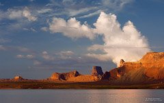 Lake Powell #39
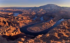 Lake Powell #9
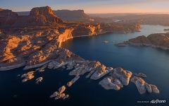 Lake Powell #62
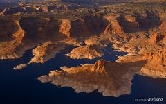 Lake Powell #68
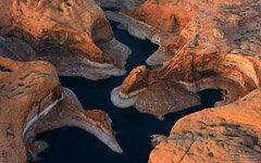 Lake Powell #23
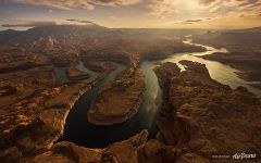 Lake Powell #49
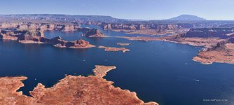 Lake Powell #5
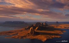 Lake Powell #81
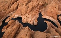 Lake Powell #92
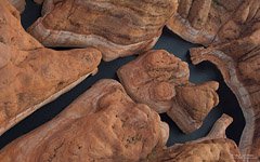 Lake Powell #33
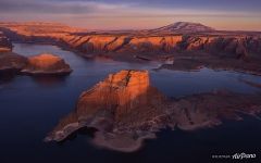 Lake Powell #59
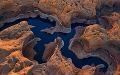 Lake Powell #20
Virtual Travels in 360°
 Rehearsal of the Russian Navy parade 2017
 Cesky Krumlov, Czech Republic
 Bora-Bora, French Polynesia
 Trip to Montenegro
 Scenic flight over Los Angeles, California, USA
 Jellyfish Bay, Raja Ampat, Indonesia
 Rio de Janeiro. The Marvelous City
 Russia's aerobatics team Berkuts
Show more


