Everest, Himalayas, Nepal, Part I, January 2012
From editor
Every time Dima goes on a photo trip to shoot mountains, our entire team impatiently awaits for the news from the front lines. That's right, from the front lines, because Dima traditionally finds all sorts of adventures in the mountains. It may be a suddenly malfunctioning camera, or unexpected weather changes. Or a volcano, just recently shooting a 20km-tall column of ashes, would suddenly go to sleep... Dima's personal view on such events is rather philosophical: he believes that one's entire life is governed by karma, the law of cause and effect. In order to get a deeper understanding of this mysterious phenomenon, he joined a yoga tour to India and Nepal. Obviously, when Dima suddenly called and told us that he was going to shoot Mount Everest in a couple of hours, all of us — to the best of everyone's individual skills — sent positive vibrations his way in hope to change his karma. Alas, our skills had their limits. At the end of the day we got another phone call: Dima happily informed us that he had a fantastic flight, and that there were so many beautiful mountains around. He even saw Mount Everest and tried to shoot it, but... he had to go back due to the hard crosswind that stopped their helicopter few kilometers before Everest. After that, one by one, two of his three cameras broke down. Our colleague Ivan Roslyakov dragged us out of our depression by saying: "The tour needs a spherical panorama of Mount Everest? No problem! About six months ago I went on a trekking expedition to Nepal. We took the same route, as Dima's helicopter did. We even managed to get a bit higher than Dima, so I photographed Mount Everest". The idea of combining aerial shots from the helicopter and ground photography seemed very good. Let's take a moment and listen to Dmitriy Moiseyenko's exciting story of his flight to Mount Everest before viewing our new virtual tour.
The trip to Mount Everest
It was my fifth trip from India to Kathmandu, the capital of Nepal. Tired of walking the streets, I decided to stop at one of the restaurants with a fabulous view of Boudhanath stupa for a cup of tea with honey.
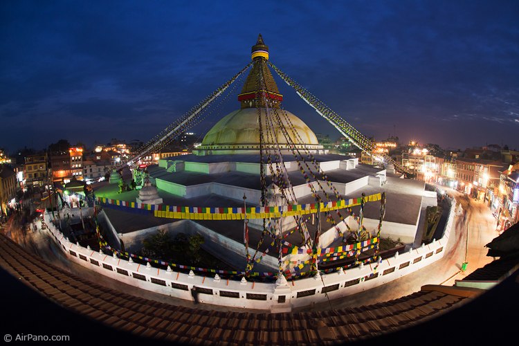
Boudhanath stupa in Kathmandu
Here I was, sitting by the window, when suddenly my tranquility was interrupted by a couple of helicopters cutting through the evening sky... My mind immediately concentrated: if there were helicopters, there was so much to do! That same evening I visited a travel agency, where they told me, "Yes, helicopters were available. But, no, flights over Kathmandu were prohibited. However, yes, there were plenty of alternative routes" The list of alternative routs' names sent my head spinning, and my mind clung to one familiar word — Mount Everest!
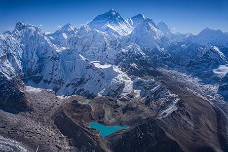
Note: The border of China and Nepal goes right through the peak of the highest mountain in the world (8 848 meters). Or, the border of Tibet and Nepal. The definition entirely depends on reader's political views. Mt. Everest is a part of the Himalayas, a rather narrow mountain range that separates the Indian and the Asian tectonic plates (the Tibetan Plateau) Ten out of fourteen 8K Peaks are located in the Himalayas, and the rest of them in the nearby Karakoram Range.
I must say that I have seen Mount Everest more than once. I remember my first time, looking out from a Tibetan toilet, which was built on the elevated ground, without a door, and with waist-high walls — so that the "occupant" could enjoy a magnificent view of Mt. Everest being visible to others during the process... The second time I saw it from the plane going from Kathmandu to Lhasa. The third time was from the Tibetan side again, but much closer, from the base camp on 5300m altitude. Recalling this wall of snow, rising over the "not so low" Tibetan plateau, I tried to imagine how would The Mountain look from the Nepalese side...
Note: It is known that 90% of Mount Everest ascensions begin in Tibet, and only 10% in Nepal. The ratio of climbers who make it to the base camp is just about the same. The base camp hosts all expeditions. This is where climbers go through altitude acclimatization, prepare their gear, and test their equipment before the summit...
I sent out requests to three helicopter companies, and only one replied on the next day: we can fly to Everest!
The helicopter could get up to 20 000 feet (about 6 300 meters), the wind was acceptable — 50 km/h, the temperature at the highest altitude was -35C degrees. Well, it was winter after all. January of 2012...
Since I always shoot through the open door, it was time for some shopping. After an hour of bargaining at the local shop, the entire set of gear: North Face two-layered fleece jacket, North Face down parka, K2 gloves, High Tech boots and a Nepalese knitted hat — was purchased for just 94 USD.
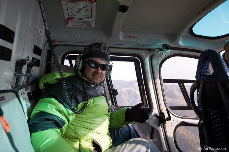
It is -35C outside, and the door must remain open
Next morning I learned something very interesting in the office of the helicopter company: there was a weather station in the base camp area, but it's been silent for a month. They expected it to be fixed in the summer. Weather updates could be received over the phone from the nearest village. Or from Google. So far the day was clear, not a single cloud. However, yesterday, all flights were canceled due to the strong wind.
A map was spread over the table. "Well, — said the Nepalese, — where do you want to go?" "Oh, no! This is my first time here, so please take me to where I can have the best view on Mount Everest, flying next to the face of the mountain". They said, "Well, it could be complicated, since there is a couple of 7K peaks right in front of it, but don't worry, you'll get the best Everest view. Now, let's hurry up, before the wind gets stronger." Then the pilot spoke up, "I'm not flying with this madman alone. He wants to open the door! What if the wind blows harder, and the helicopter gets knocked off? Or what if we loose all oxygen, and I faint, and he falls out? That's it, I need an assistant. And several oxygen masks!"
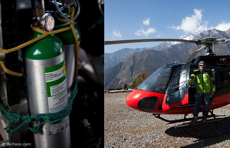
Oxygen tanks
Finally, we were in the airport. A perfect morning haze covered Kathmandu village as we took off, flying over the suburbs, brick plants, smokestacks, fields, and hills... Since the greater part of Nepal lies on the foothills of the Himalaya, local people spent last couple of thousand years converting most of the hills into agricultural terraces to maintain food supply. These terraces stretch over 200 kilometers from Kathmandu to Everest.
After 40 minutes flight we stopped in Lukla, the Sherpa village. This was the last village with an airfield before the base camp. One end of its runway went right into the mountains, and the other ran over a cliff. Thank God, we had a helicopter. We dropped the fuel that we'd use on our way back, had a cigarette and took off! Our helicopter was flying between the mountains, not above them... The pilot pointed out "Everest!" From my previous trips to Tibet I leaned how to tell Mount Everest from others — there is always a little cloud at the side of its peak. Actually, it must be one of Nature's special tricks to show little humans who's the boss. It was Everest alright, but only that its peak was barely visible between other peaks. However down below we could see the monastery, the last one before the base camp, right on the mountain pass, surrounded by cliffs. Here it was, the first point! I was taking pictures, than doing a second take... Checking... Hm, the focus was off... No problem, I will shoot it again on the way back.
We kept on flying, the altitude was over 4 km, snowy plateaus and frozen lakes just started to appear in front of me... Suddenly, we went down. Why? The pilot replied, "We have to let go of two people, we are going to fly really high, we must have enough power"... I asked him, "How are you going to fly without a second pilot?" The pilot didn't answer, unloaded my friend and his co-pilot, handed me the oxygen mask and showed how to put it on.
We took off and in 10 minutes we were going around a huge mountain. The pilot pointed at the glacier covered with shining blue cracks, a rather young glacier, and said "the base camp". I pointed at it "Let's go there!" We approached the turn of the ice river flowing from the highest mountain. Almost there! Little bit longer, and we would see Mount Everest in all its glory... And suddenly... It felt like someone's hit the breaks... We stopped and started slowly moving backwards. In surprise I looked at the pilot, pointing my finger, as if to say "forward!" But for some reason he looked frightened, shaking his had "no". "The wind! He said, "I can't go there, the wind is too strong". There was not a single cloud in the sky; the ice lake was shining in reflections of the sunlight... Nothing spoke of the wind, only the pilot quickly turned around the helicopter, starting to pick up speed, going into the opposite direction. "Hey!" I shouted not into the microphone, but directly into his back. "We still have to shoot"... "No way, I'm not going there," he said... And suddenly I realized the horror of the situation: I was only several kilometers away from Everest, even though its face was hidden behind a couple of other 7K Peaks, but nevertheless, its peak was visible... We were at the altitude of 6 000 meters, breathing oxygen, it took us 1.5 hours to get here, it cost a lot of money, and just because the "driver" was panicking I was supposed to go back empty-handed? No way! I counted to 10, and started praising my pilot: he was a high professional, an ace with a total control over his iron bird, I didn't even notice any wind, and "I'm sure you know how to fly even in storm"... Besides, if we would go back and fly a little higher, we wouldn't have to go that far, we could stay here, a bit closer. Something clicked in the pilot's mind, "Well, I'll try going up and closer, but just once, and not too high..."
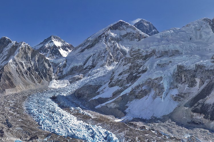
Mount Everest view
... Well, I must say that the helicopter was indeed shaking at that altitude ;) Only the thought of disappointed colleagues (if I don't bring decent pictures of Mt. Everest) made me push the pilot, over and over again, to go back to where we could see just a glimpse of the highest mountain in the world... He complained that the wind was crazy, tried to run away, and didn't want to fly higher, hiding by the glacier. Finally I realized that we've reached the limit of his courage, and that it was no chance to get any more of Everest out of him. So I said, "Let's go back" and immediately heard a long sigh of relief.
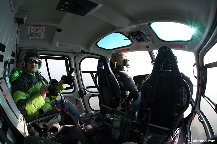
Two cameras will be dead soon
We quickly picked up our friends that were freezing at 4 200 meters altitude. Here was the monastery again... I remembered about my plan to shoot it on the way back. I asked the pilot to slow down. He grumbled once again, this time about the fuel. I started shooting and noticed that my camera acted very odd — no signs of life, whatsoever. First of all I changed the battery — same result. The pilot kept on grumbling in my headphones, and I almost snapped at him to shut up, but then remembered that I was on a yoga tour, and that anger was not a good thing. I took out my second camera, changed the lens right there on my lap, by the open door, attached cords and adjusted settings. The moment I started shooting, I got this funny feeling again, that something was going wrong. And indeed it was. All settings zeroed out, the screen read "0 hours 0 minutes 01.01.2001. Set up the time to begin"... This was suspicious... I grabbed my friend's camera, which he used to film our flight, changed all settings once again (the pilot was boiling with anger)... This time, the camera worked great, and we were off to Lulka airport to fuel up. A short break... On our way back I shot the terraces with my last working camera...
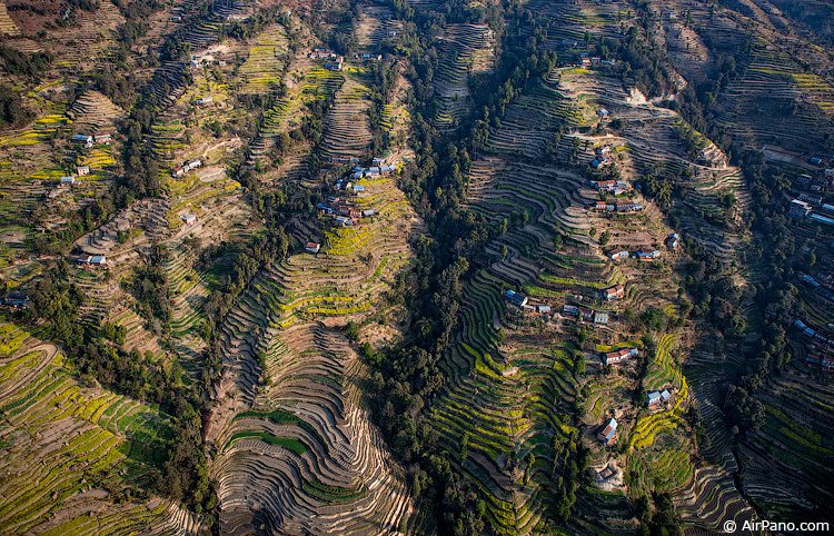
Terraces about kilometer high
After the flight I inspected all my cameras: the first one was completely dead; settings on the second one had to be reset from scratch; and — oh, mystery — the third surviving camera was not mine! I borrowed it from my yoga instructor, who guided our group in India and Nepal. It was obvious: I had to work much more on my karma.
Photography and text by Dmitry Moiseenko and Ivan Roslyakov
01.03.2012
Apart from the current virtual tour you can see another one "Everest, Himalayas, Nepal, Part II, December 2012" and read article about the trip.
Read more
Photogallery Himalayas
 Everest sunset view from Renjo La Pass
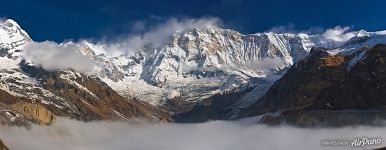 Misty morning at Annapurna BC
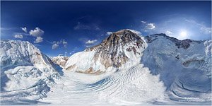 Everest from the altitude of 7100 meters
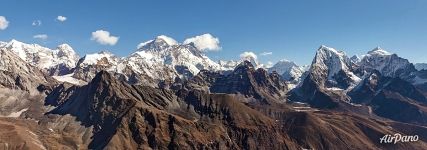 Everest from the Gokyo Valley
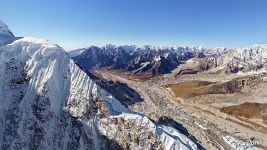 Near Nuptse mountain
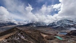 View from the top of the Kala Patthar
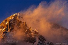 Sunset view of Cho Oyu
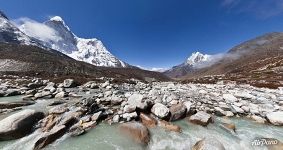 Over the Imja River
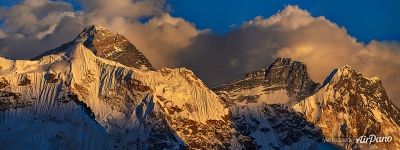 Panorama of Everest (21923x8215 px)
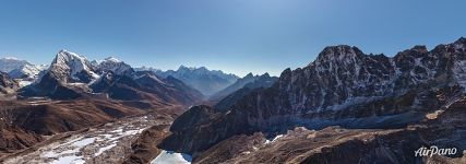 Above Gokyo Valley
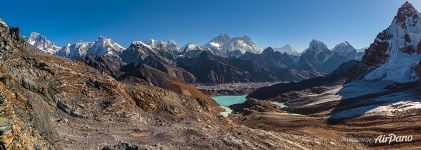 Everest and Gokyo Lakes, view from the Renjo-La
Virtual Travels in 360°
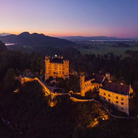 Fussen Town, Neuschwanstein and Hohenschwangau Castles, Germany
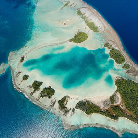 Rangiroa, French Polynesia
 Altai, Chuya and Kuray steppes. Russia
 Alhambra, Granada, Spain
 Diving with Manta Rays, Raja Ampat, Indonesia
 Kambalnaya River. Part I
 Bears of Kambalnaya river. Part III
 Kamchatka Peninsula, Eastern coast, Bering sea, Russia
Show more


