Azores, São Miguel Island, Portugal
The archipelago of the Azores is a part of Portugal. Its name is considered to be originated from the ancient word "azures" meaning blue, or azure colour. The legend, although, associates it with the word açor ("goshawk" in Portuguese), as if hawks flying to their nests showed the sailors the way to the islands. But in fact, this bird has never inhabited this island, so scientists deny this version.

"Azure" is an entirely appropriate description of the archipelago. Endless ocean frames the wonderful landscape of nine islands having volcanic origins. São Miguel is the largest island of the archipelago with the total area of 744.55 km2 and a population of around 140 thousand people.

The shape of the island is long and narrow, stretching from west to east and consisting of two volcanic massifs divided by a mountain range. The highest elevation on the island is Pico da Vara at 1,103 metres above sea level lying at the eastern end of the island.

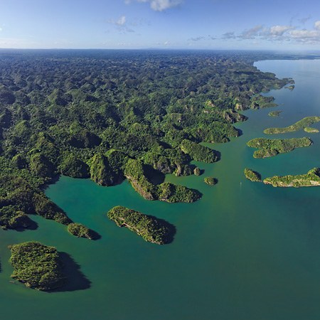
The largest pool of water is Lagoa das Sete Cidades situated in the crater of a dormant volcano. The name is the Portuguese for "Lagoon of the Seven Cities". According to a legend, in the 13th century, seven expelled bishops being chased by the Arabs found an island in the Atlantic Ocean and founded seven settlements here.

Lagoa das Sete Cidades is the complex of the two lakes with blue and green water. Its origin is connected to an ancient tale, too. The story tells that the princess once lived in this area. Her father, the king, would not let the princess see the shepherd, and the lovers cried at their separation and their tears formed two beautiful lakes: one Lagoa Azul, for the princess's eyes were green, and the other Lagoa Verde, for the shepherd's eyes were likewise coloured.
In the southern part of São Miguel, there is a charming village of Vila Franca do Campo founded in the 15th century and preserving its ancient traditions. Its heritage, Ermida de Nossa Senhora da Paz, for example, has a very interesting history. This temple was built on a hill where an image of the Virgin was found in the 16th century. The place for the temple was chosen to be slightly below the summit of the hill, but every morning the construction supplies magically returned to the top and it's where it was built. The modern version is dated 1764, and there is the staircase leading upwards with each flight decorated by the Biblical tiles.

In the eastern part of São Miguel, there is Vale das Furnas that is famous for its fumaroles (basins) filled with healing waters, mud and thermal springs. The western part of two calderas is occupied by a crater lake, Lagoa das Furnas, at an elevation of 359 metres. There are dozens of springs, each of differing temperatures and chemical compositions. The local inhabitants have adapted to cook dishes in the geysers!

The coast of the island has numerous scenic viewpoints: Ponta da Madrugada, Ponta Do Sossego, Salto da Farinha in the east, Miradouro de Santa Iria in the north and many others. They can offer you the beauty of the landscapes and nature of this "green island", as São Miguel nicknamed. But even being far away from here, we can enjoy the journey to this place thanks to AirPano panoramas.
Photos by Max Guzovsky and Oleg Gaponyuk
Read more
Photogallery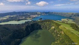 Above Lagoa de Santiago
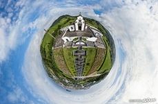 Ermida de Nossa Senhora da Paz. Planet
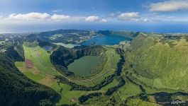 Lakes in the crater of a dormant volcano
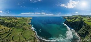 Coast of the Atlantic Ocean
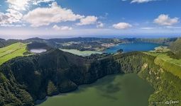 Above Lagoa de Santiago
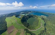 Lakes at São Miguel Island
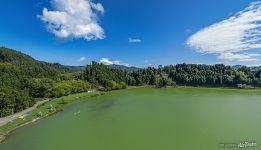 Lagoa das Furnas
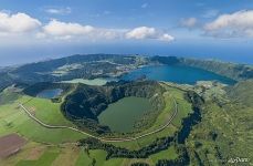 Lakes in the crater of a dormant volcano at São Miguel Island
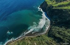 Coast of the Atlantic Ocean
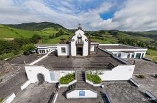 Ermida de Nossa Senhora da Paz, Vila Franca do Campo
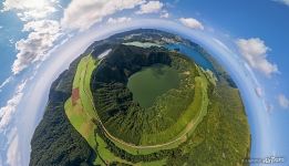 Above Lagoa de Santiago
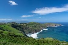 São Miguel Island

